 Engineering & Software
GIS-Based Building Inventory
Prioritise regional earthquake risk on the map: building-level performance scores using the RYTEİE 2019 simplified methods, web/mobile field data collection, a control–approval workflow and thematic risk maps.

Fast, map-based preliminary assessment of a large building stock
The software was developed within the master's thesis (2023) of Osman Murat KAYA, one of Fizibil's co-founders, at the Department of Civil Engineering of Eskişehir Osmangazi University, titled "Development of a GIS-Based Application for Determining the Regional Earthquake Risk Distribution Using Simplified Methods According to RYTEİE 2019".
It was used by the Eskişehir Branch of the TMMOB Chamber of Civil Engineers under a joint service protocol of the Odunpazarı and Tepebaşı municipalities in Eskişehir; data for about 22,000 buildings was collected with the system in the first stage of the inventory. Field data was entered by civil engineers who had passed an exam set by the scientific board.
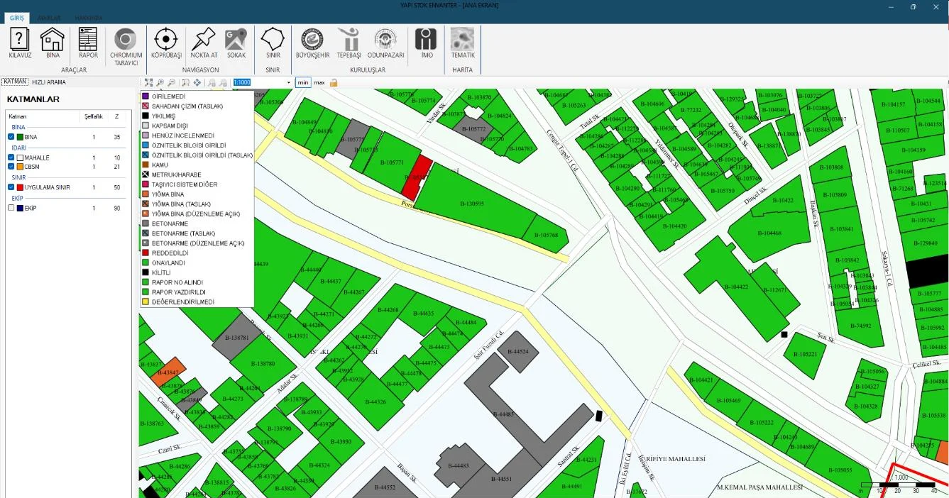
Performance scores with the RYTEİE 2019 simplified methods
Each building's performance score is calculated over 12 parameters with the relation PP = TP + Σ(Oi·OPi) + YSP. The scores are used to prioritise areas, not individual buildings: they show which neighbourhoods and building groups need a more detailed assessment.
Reinforced concrete buildings
Reinforced concrete frame and frame-shear wall buildings with 1–7 storeys: number of free storeys, visual quality, soft/weak storey, vertical and plan irregularity, heavy overhangs, short columns, building arrangement and floor level, natural ground slope.
Masonry buildings
Masonry type, number of storeys, building arrangement, current condition and quality, plan irregularity, amount of walls, vertical openings, storey difference by façade, soft storey, out-of-plane behaviour and roof material.
Automatic seismic hazard
The AFAD Turkish Earthquake Hazard Map grid is embedded in the application; Ss, Fs and SDS are interpolated automatically from the building's coordinates, and the score is shown instantly on a gauge.
From field to approval without losing records
Field
Two-person teams enter building data, photos and location through the web/mobile interface within their assigned work area, and can draw buildings missing from the map.
Attributes
In the desktop application, identity data is completed with land registry (TKGM) parcel queries and national address database (UAVT) data, building geometry is corrected and cross-checked with street-level imagery.
Control
A control engineer reviews the record; faulty records are rejected with a reason code and the team can fix them before leaving the site.
Approval and report
For each approved building, an A4 data collection form with a cover photo, verifiable by QR code, is produced; approval reversals are logged.
See risk at neighbourhood scale
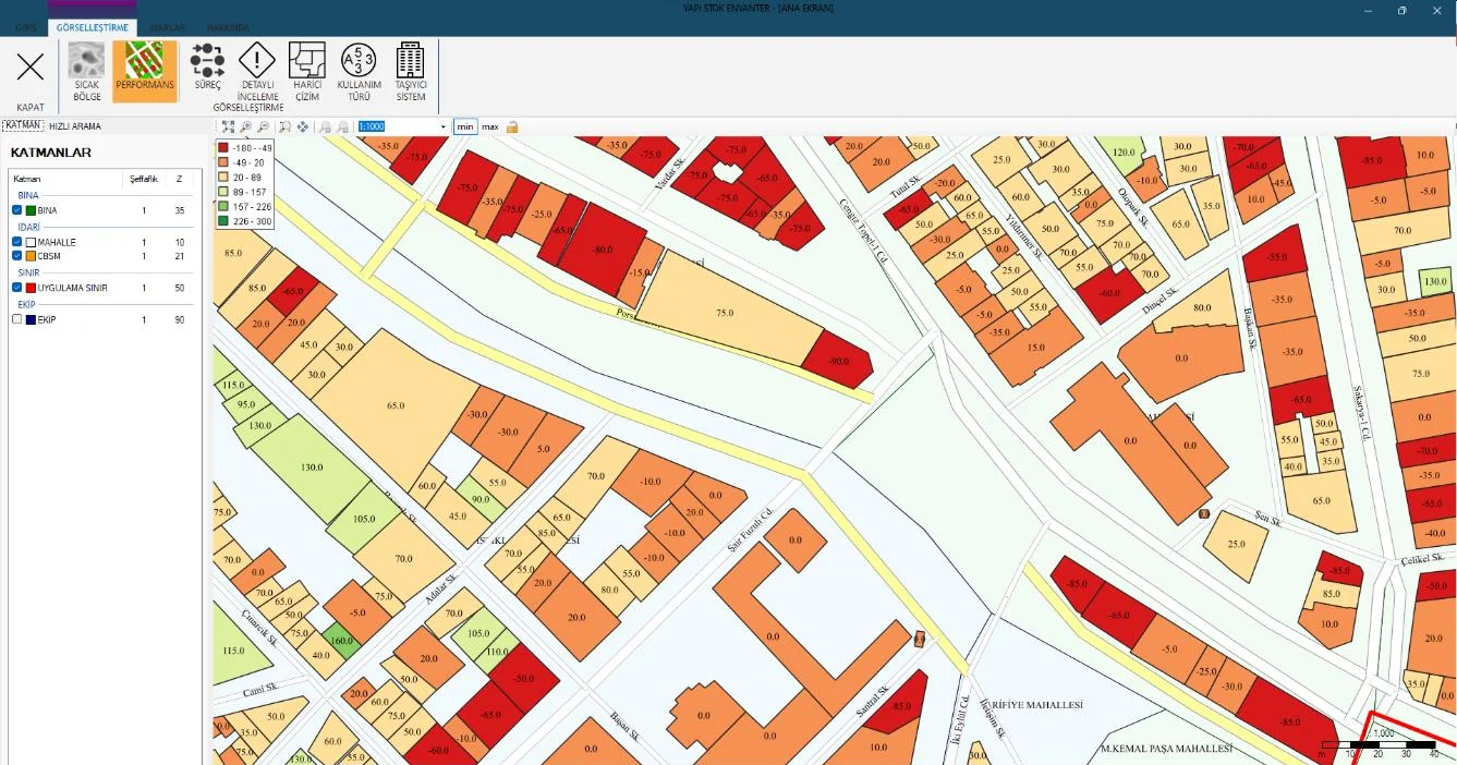
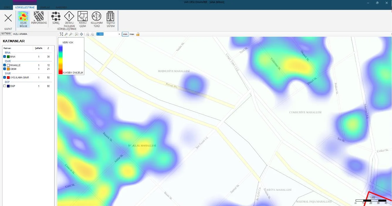
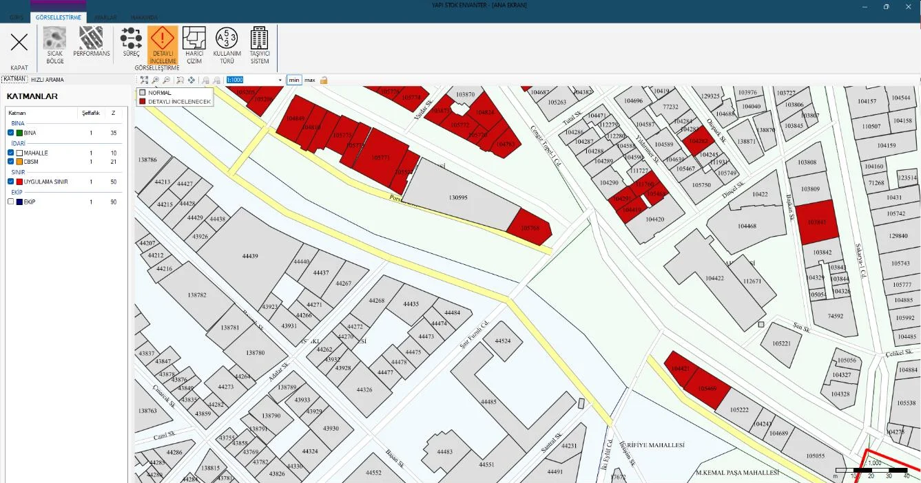
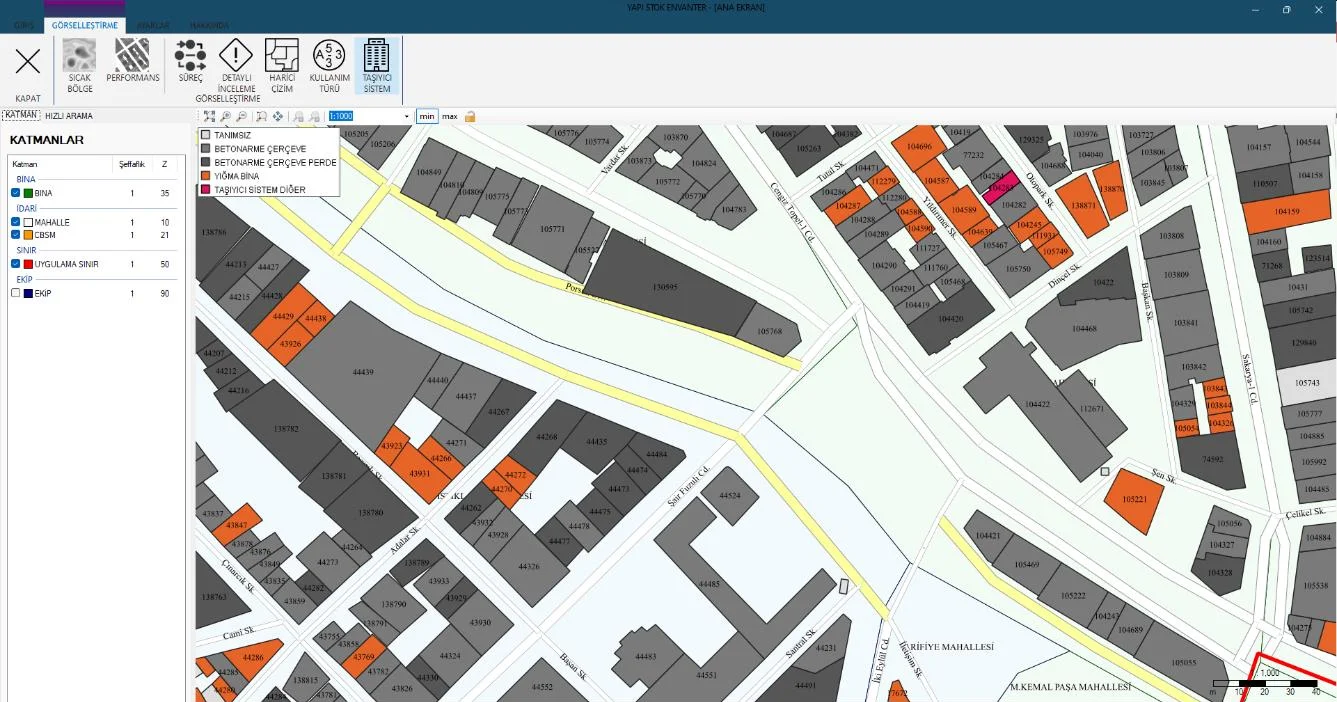
Three-tier architecture that fits institutional infrastructure
Data tier
PostgreSQL + PostGIS spatial database; SQLite/SpatiaLite for local synchronisation; support for spatial files such as GeoTIFF, GeoJSON and SHP.
Application tier
WMS/WMTS/WFS services and CQL filters via GeoServer; REST API integration with municipal systems and SOAP services for secure data sharing with other public institutions; MQTT pushes changes instantly to other users' screens and prevents duplicate entries.
Presentation tier
Licensed Windows desktop application, interactive web maps with OpenLayers and a responsive mobile interface for the field. Building geometries come from MAKS or municipal city information system data; the software can be used in any province with MAKS data.
Verifiable output, measurable progress
For each approved building, an A4 data collection form specific to reinforced concrete or masonry buildings can be printed in bulk. The form includes a cover photo, a performance score gauge and a QR code that verifies the printout matches the record in the system.
- Map printouts, PDF and Excel reports
- Statistics by status, process and neighbourhood
- Staff performance reports for a given date range
- Import of scores from other methods such as AURAP and PERA
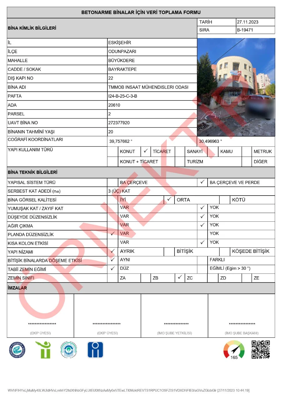
Key features of the software
- Desktop, web and mobile interfaces writing to a shared database
- Automatic performance score with the RYTEİE 2019 Annex-2 simplified methods
- Automatic SDS from AFAD seismic hazard data
- Land registry (TKGM) parcel queries and national address (UAVT) integration
- ITRF96 ↔ WGS84 conversion; 3° Gauss-Krüger projection support
- Team and work area management, geometry error checks
- Control–approval workflow with reason codes and an audit log
- Seven thematic maps: heat, performance score, process status, detailed assessment, external drawing, usage type, structural system
- Bulk A4 form printouts verifiable by QR code
- PDF and Excel reports
- REST API integration with municipal systems
- Flexible on-premises or cloud deployment
- Licence key and forced update mechanism
Who is it for?
Municipalities, provincial directorates of environment and urbanisation, urban transformation units, disaster management agencies and professional chambers. The system is designed to identify, within a large building stock, the areas that should be prioritised for detailed assessment.
Scope note: simplified methods do not determine the strength of individual buildings; they are intended for regional prioritisation. Steel and precast buildings are outside the scope of the method.
Related products and solutions
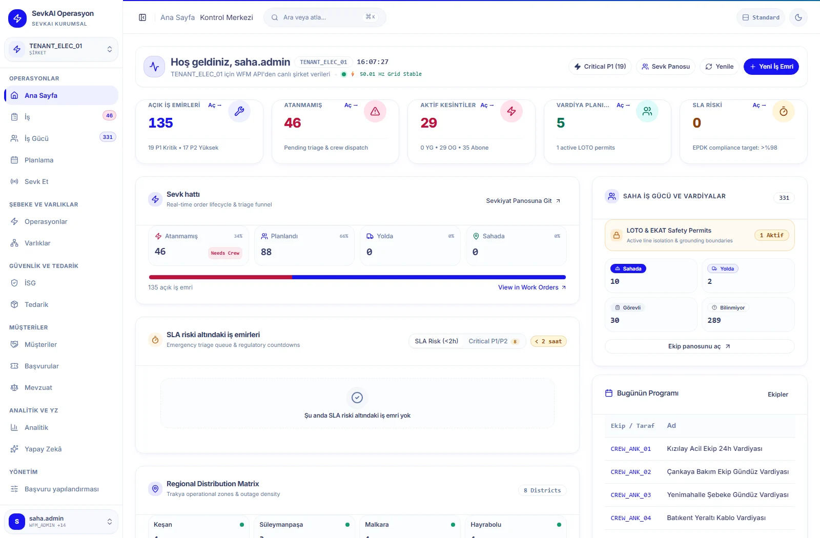
SevkAI — Workforce Management (WFM)
Operations software for electricity distribution companies that brings dispatch, field work, the network and SAP integration together on one platform.
Learn more →
Web Development
Enterprise web applications, portals and custom software development.
Learn more →
Mobile Development
iOS and Android apps; offline field applications and on-device AI.
Learn more →Demo or quote for GIS-Based Building Inventory
Fill in the form and we will show you the product at a time that suits you, or prepare a price quote for your use case.